How Satellite Technology is Useful in Weather Forecasting and Climate Monitoring
How Satellite Technology is Useful in Weather Forecasting and Climate Monitoring
Satellite technology has revolutionized weather forecasting and climate monitoring, providing scientists and meteorologists with unprecedented data and insights into Earth’s atmospheric and environmental conditions. From real-time weather predictions to long-term climate change analysis, satellites play a crucial role in understanding and mitigating the effects of natural disasters, extreme weather events, and global warming. This article explores how satellite technology contributes to these essential areas, discussing various types of weather satellites, their functions, and the impact of their data on our daily lives.
The Role of Satellites in Weather Forecasting
1. Real-time Data Collection
Weather satellites provide real-time data on atmospheric conditions, including temperature, humidity, wind speed, and cloud cover. This information is crucial for meteorologists to develop accurate weather forecasts and predict extreme weather events such as hurricanes, storms, and tornadoes.
2. Types of Weather Satellites
There are two primary types of weather satellites used for forecasting:
- Geostationary Satellites (GEO): These satellites orbit at an altitude of approximately 35,786 kilometers above the equator. They remain fixed over a particular region, continuously monitoring weather patterns and providing real-time updates.
- Polar-Orbiting Satellites (LEO): These satellites orbit the Earth at lower altitudes (typically between 800-1,200 kilometers) and provide detailed global coverage by scanning different regions as the planet rotates beneath them.
3. Satellite Imagery and Weather Prediction
Weather satellites capture high-resolution images of cloud formations, ocean currents, and atmospheric changes. These images help meteorologists identify weather patterns and track the development of storms, hurricanes, and other extreme weather conditions. By analyzing satellite images over time, forecasters can make more precise predictions about weather trends and potential natural disasters.
4. Remote Sensing and Radar Data
Satellites equipped with remote sensing instruments use various technologies, such as infrared and microwave sensors, to measure atmospheric conditions. These measurements help detect temperature variations, moisture levels, and wind patterns, contributing to improved weather modeling and forecasting.
The Role of Satellites in Climate Monitoring
1. Tracking Global Temperature Changes
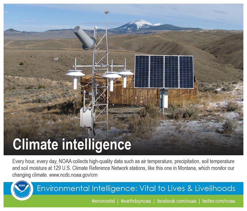
Climate monitoring requires long-term data collection to analyze trends and detect changes in global temperatures. Satellites provide continuous temperature records, helping scientists study global warming, ice cap melting, and shifts in climate patterns over decades.
2. Monitoring Greenhouse Gas Emissions
Satellites equipped with specialized sensors measure the concentration of greenhouse gases (GHGs) such as carbon dioxide (CO2) and methane (CH4) in the atmosphere. These measurements help researchers understand the sources and effects of GHG emissions, contributing to efforts to mitigate climate change.
3. Observing Oceanic and Atmospheric Changes
The interaction between oceans and the atmosphere plays a crucial role in climate regulation. Satellites monitor sea surface temperatures, ocean currents, and sea-level rise, providing valuable data for climate modeling and understanding phenomena like El Niño and La Niña.
4. Deforestation and Land Use Changes
Satellite imagery is used to track deforestation, desertification, and land-use changes. These observations help scientists assess the impact of human activities on the environment and develop sustainable land management strategies.
Advances in Satellite Technology for Weather and Climate
1. High-Resolution Imaging and Data Collection
Modern satellites are equipped with advanced imaging sensors capable of capturing high-resolution images with greater accuracy. These images help improve weather predictions and enhance climate change monitoring.
2. AI and Machine Learning Integration
Artificial intelligence (AI) and machine learning algorithms are now being integrated into satellite data analysis. These technologies help process vast amounts of data, identify patterns, and improve predictive models for weather forecasting and climate monitoring.
3. CubeSats and Miniaturized Satellites
The development of small satellites, known as CubeSats, has made satellite deployment more cost-effective. These miniaturized satellites provide supplementary data to enhance weather models and climate studies.
4. Improved Sensor Technology
New sensor technologies, such as hyperspectral imaging and LIDAR (Light Detection and Ranging), allow satellites to collect more detailed information about the Earth’s surface, atmosphere, and oceans.
Impact of Satellite Technology on Society
1. Disaster Preparedness and Response
Satellites help predict natural disasters such as hurricanes, floods, and wildfires, allowing governments and emergency responders to take preventive measures. Early warnings save lives and minimize economic losses.
2. Agriculture and Food Security
Accurate weather forecasts based on satellite data help farmers plan their planting and harvesting schedules, optimizing crop yields and ensuring food security.
3. Aviation and Maritime Safety
Satellites provide crucial weather data for aviation and maritime industries, helping pilots and ship captains navigate safely through adverse weather conditions.
4. Climate Policy and Environmental Protection
Governments and environmental organizations use satellite data to develop climate policies, enforce environmental regulations, and track progress in reducing carbon emissions.
Satellite technology has transformed weather forecasting and climate monitoring, providing invaluable data that enhances our understanding of atmospheric and environmental changes. As satellite capabilities continue to advance, their contributions to mitigating climate change, predicting extreme weather events, and protecting lives and property will only become more significant. By leveraging satellite data, humanity can make more informed decisions to safeguard the planet for future generations.