How Satellite Technology is Used in Navigation and Location Services:
Satellite technology has become an indispensable part of our daily lives, shaping how we navigate, communicate, and interact with the world. From finding the shortest route to a destination to enabling critical search-and-rescue missions, satellites provide the backbone for modern navigation and location-based services. In this article, we will explore how satellite technology works in navigation, examine its advantages and disadvantages, highlight the latest research advancements, and provide a glimpse into its future potential.
The Role of Satellite Technology in Navigation and Location Services
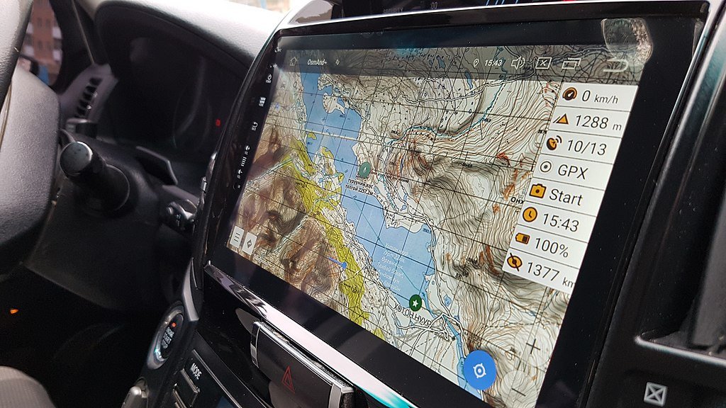
Satellite technology operates through networks of satellites orbiting the Earth, transmitting signals that can be received and processed by ground-based devices. These devices, such as smartphones, GPS receivers, and vehicle navigation systems, use the signals to determine their location, speed, and time with incredible precision.
The Global Navigation Satellite System (GNSS)
The foundation of satellite-based navigation lies in the Global Navigation Satellite System (GNSS), a collective term for satellite constellations providing global positioning and timing services. The most well-known GNSS systems include:
- GPS (Global Positioning System): Operated by the United States, GPS was the first fully operational GNSS and remains one of the most widely used systems globally.
- GLONASS: Russia’s GNSS, offering global coverage and high accuracy.
- Galileo: The European Union’s GNSS, designed to provide superior accuracy and integrity, particularly for critical applications.
- BeiDou: China’s GNSS, which has rapidly grown into a global system with extensive applications.
How It Works
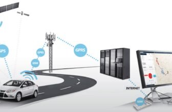
Satellite navigation systems operate using a method called trilateration. Here’s how it works:
- Signal Transmission: Satellites continuously transmit signals containing their location and the exact time the signal was sent.
- Signal Reception: A GNSS receiver, such as a smartphone, picks up these signals from multiple satellites.
- Distance Calculation: By calculating the time it took for the signal to travel, the receiver determines its distance from each satellite.
- Location Determination: Using signals from at least four satellites, the receiver calculates its precise location in three dimensions: latitude, longitude, and altitude.
This combination of precision and global coverage makes satellite technology essential for a wide range of navigation and location services.
Advantages of Satellite Technology in Navigation
The adoption of satellite technology has transformed navigation and location services in profound ways. Some of its most significant advantages include:
1. Global Coverage
Satellite systems provide near-global coverage, allowing users to navigate almost anywhere on Earth, from bustling cities to remote wilderness.
2. High Accuracy
Modern GNSS systems offer exceptional accuracy, often within a few meters. This level of precision is vital for applications like aviation, maritime navigation, and autonomous vehicles.
3. Real-Time Navigation
Satellite technology enables real-time navigation, ensuring users can receive up-to-date directions and traffic information. This is particularly valuable for road transportation and logistics.
4. Versatility
From personal use in smartphones to critical applications in defense and disaster management, satellite navigation supports a broad spectrum of industries and services.
5. Time Synchronization
Beyond location services, GNSS systems provide precise time synchronization, essential for financial transactions, telecommunications, and power grid management.
6. Enhanced Safety
In aviation and maritime sectors, satellite-based navigation improves safety by enabling accurate route planning, collision avoidance, and emergency response coordination.
Disadvantages of Satellite Technology in Navigation
While satellite technology offers numerous benefits, it is not without its challenges and limitations. Some of the key drawbacks include:
1. Signal Obstruction
GNSS signals can be blocked or weakened by physical obstructions such as tall buildings, dense forests, or tunnels. This can lead to reduced accuracy or signal loss in urban or remote environments.
2. Vulnerability to Interference
Satellite signals are susceptible to interference from natural phenomena like solar storms or man-made sources such as jamming devices. This poses risks for critical applications.
3. Dependency on Infrastructure
The reliability of satellite navigation depends on the proper functioning of satellites and ground stations. System failures or maintenance issues can disrupt services.
4. Privacy Concerns
Location-based services powered by satellite technology raise concerns about user privacy and data security, as personal location data can be misused.
5. Cost
Developing, launching, and maintaining satellite systems is expensive, with costs often running into billions of dollars. This financial burden is borne by governments and, indirectly, by users.
6. Environmental Impact
The proliferation of satellites contributes to space debris, posing risks to existing satellites and future space missions.
Latest Research and Developments in Satellite Navigation
Advancements in satellite technology continue to push the boundaries of what’s possible in navigation and location services. Some notable areas of recent research and development include:
1. Next-Generation GNSS Systems
New satellite systems, such as the updated GPS III and Galileo’s next-generation satellites, promise enhanced accuracy, reliability, and anti-jamming capabilities. These advancements aim to support emerging applications like autonomous vehicles and smart cities.
2. Integration with Other Technologies
Researchers are exploring the integration of GNSS with other technologies, such as:
- Augmented Reality (AR): Combining satellite navigation with AR to create immersive location-based experiences.
- 5G Networks: Enhancing positioning accuracy through the fusion of satellite signals and 5G cellular networks.
- Artificial Intelligence (AI): Leveraging AI to process satellite data more efficiently and improve real-time decision-making.
3. Low Earth Orbit (LEO) Satellites
While traditional GNSS satellites operate in medium Earth orbit (MEO), there is growing interest in using low Earth orbit (LEO) satellites for navigation. LEO satellites offer lower latency and improved signal strength, particularly in urban environments.
4. Quantum Navigation
Quantum technologies are being developed as a complement or alternative to traditional GNSS. Quantum navigation systems use atomic clocks and quantum sensors to provide ultra-precise positioning without relying on satellite signals.
5. Resilient PNT (Positioning, Navigation, and Timing)
To address vulnerabilities in GNSS, researchers are working on resilient PNT systems that combine satellite navigation with ground-based systems and other technologies to ensure uninterrupted service.
The Future of Satellite Technology in Navigation
The future of satellite technology in navigation is brimming with potential, driven by innovations that aim to overcome current limitations and unlock new possibilities. Here are some trends shaping the future:
1. Autonomous Vehicles
Satellite navigation will play a critical role in the development and deployment of autonomous vehicles, providing precise positioning and route planning. Enhanced GNSS systems, combined with AI and sensor technologies, will enable safer and more efficient self-driving cars, drones, and ships.
2. Smart Cities
In smart cities, satellite technology will support infrastructure management, traffic optimization, and efficient public transportation systems. Integration with IoT devices and sensors will enable real-time monitoring and decision-making.
3. Space-Based Navigation Services
With increasing interest in lunar and Martian exploration, satellite navigation is expanding beyond Earth. NASA and other space agencies are developing navigation systems for the Moon, such as the Lunar GNSS, to support future missions and lunar habitats.
4. Disaster Management and Climate Monitoring
Satellite navigation will continue to play a vital role in disaster management by enabling rapid response and resource allocation. Additionally, advancements in satellite technology will enhance environmental monitoring and climate change research.
5. Personalized Location-Based Services
The future will see more personalized and context-aware location services, powered by AI and advanced data analytics. These services will cater to individual preferences and needs, offering tailored recommendations and navigation options.
6. Enhanced Security and Privacy
To address privacy concerns, future satellite systems may incorporate advanced encryption and data anonymization techniques. This will ensure that location data is secure and used responsibly.
Satellite technology has revolutionized navigation and location services, offering unprecedented levels of precision, reliability, and global accessibility. While there are challenges to address, ongoing research and technological advancements are paving the way for a future where satellite-based navigation becomes even more integral to our lives. From enabling autonomous vehicles to supporting space exploration, the potential applications are virtually limitless.
As we look to the future, the focus will be on enhancing accuracy, resilience, and security while minimizing environmental impact. By overcoming existing limitations and leveraging emerging technologies, satellite navigation will continue to transform how we navigate and interact with the world, shaping a smarter, more connected future. image/wikimedia


