What is Satellite Monitoring?
Satellite monitoring is the process of using satellites to observe, collect, and analyze data about Earth’s surface and atmospheric conditions. Satellites orbit the planet, providing real-time or near-real-time information that helps in various domains, including weather forecasting, environmental monitoring, disaster management, and traffic control.
Satellites are equipped with sensors, cameras, and communication systems that capture images, track movements, and relay critical information to ground stations. The data gathered is invaluable for decision-making processes across multiple industries. One of the crucial areas where satellite monitoring plays an essential role is transportation, particularly in traffic monitoring and control.
How is Satellite Technology Used in Traffic Monitoring and Control?
Traffic congestion is a major problem in urban areas, leading to increased fuel consumption, economic losses, and environmental pollution. Traditional methods of traffic monitoring, such as roadside cameras, sensors, and manual observation, often fail to provide comprehensive data, especially in vast and remote areas. This is where satellite technology comes into play.
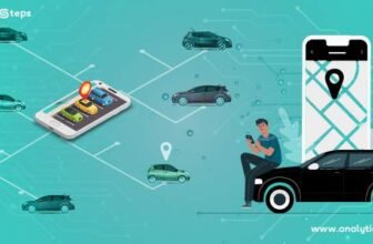
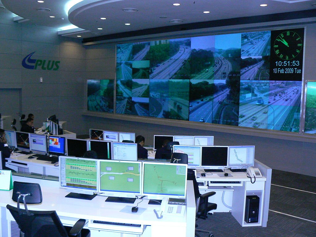
- Real-Time Traffic Analysis Satellites equipped with optical and radar sensors capture images and detect vehicle movements on roads. These images help authorities analyze traffic patterns, identify congestion points, and manage vehicle flow efficiently.
- GPS-Based Navigation and Route Optimization Global Positioning System (GPS) technology, which relies on satellite signals, is widely used in navigation applications. GPS data assists drivers and transportation companies in finding the best routes, avoiding traffic jams, and reducing travel time.
- Incident Detection and Emergency Response Satellite imagery and communication systems help detect accidents, roadblocks, and other incidents in real time. Emergency response teams use this information to dispatch help quickly, improving road safety.
- Smart Traffic Signals and Urban Planning Satellite data is used to develop intelligent traffic light systems that adjust signals based on traffic density. It also aids city planners in designing roadways, highways, and public transport systems that align with actual traffic trends.
- Weather Monitoring for Traffic Safety Severe weather conditions can impact traffic and road safety. Satellites track storms, heavy rainfall, and snowfall, providing crucial updates to drivers and traffic authorities to take precautionary measures.
- Monitoring Air Pollution from Traffic Transportation is a significant contributor to air pollution. Satellites monitor pollution levels in urban areas and help policymakers implement regulations to control vehicle emissions and promote eco-friendly transport solutions.
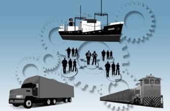
How Are Satellites Applied in Transport?
The transportation sector benefits immensely from satellite technology in various ways, enhancing efficiency, safety, and sustainability. Here are some key applications:
- Aviation Navigation and Safety Airlines rely on satellite-based navigation systems such as GPS and the Global Navigation Satellite System (GNSS) for flight planning, real-time tracking, and improving airspace management. These systems ensure precise navigation and reduce flight delays.
- Maritime Transport and Vessel Tracking Satellites provide Automatic Identification System (AIS) data for tracking ships and managing maritime traffic. This technology is vital for preventing collisions, optimizing shipping routes, and ensuring compliance with international maritime laws.
- Railway Monitoring and Scheduling Satellite technology helps railway operators monitor train movements, schedule operations, and detect infrastructure damage. Real-time GPS tracking enhances rail safety and efficiency.
- Fleet Management and Logistics Logistics companies use satellite technology to track vehicles, monitor cargo shipments, and optimize delivery routes. This improves fuel efficiency, reduces costs, and ensures timely deliveries.
- Border Security and Vehicle Monitoring Governments use satellite surveillance to monitor cross-border vehicle movements, detect illegal transportation activities, and enhance national security.
- Public Transportation Optimization Cities integrate satellite-based data into their public transport systems, enabling better scheduling of buses and trains, real-time passenger information, and improved overall transport efficiency.
Does Air Traffic Control Use Satellites?
Yes, air traffic control (ATC) relies on satellite technology for efficient management of aircraft movements and ensuring passenger safety. Some key satellite-based systems used in air traffic control include:
- Automatic Dependent Surveillance-Broadcast (ADS-B) ADS-B is a satellite-based surveillance system that enables aircraft to broadcast their GPS-determined position, speed, and altitude. It enhances situational awareness for air traffic controllers and pilots, reducing the risk of mid-air collisions.
- Satellite-Based Navigation Systems The use of GPS and GNSS provides accurate positioning and navigation, allowing aircraft to fly more direct routes, minimize fuel consumption, and reduce flight time.
- Satellite Communication for Air Traffic Management Satellites enable seamless communication between pilots and air traffic controllers, especially in remote regions where traditional radar coverage is limited. This ensures smooth coordination and improved flight safety.
- Weather Monitoring and Hazard Detection Satellites provide real-time weather updates, allowing ATC to reroute flights and prevent accidents due to adverse weather conditions such as turbulence, storms, and volcanic ash clouds.
- NextGen Air Traffic Management The Federal Aviation Administration (FAA) and other global aviation authorities are implementing NextGen air traffic control systems, which rely on satellite technology to improve airspace efficiency, reduce congestion, and enhance overall aviation safety.
Satellite technology has revolutionized traffic monitoring, transportation management, and air traffic control, making travel safer, more efficient, and environmentally sustainable. By leveraging satellite data, governments and private sectors can improve infrastructure planning, enhance emergency response, and optimize transport systems for the future. As technology advances, the integration of artificial intelligence and machine learning with satellite monitoring will further enhance traffic and transport solutions, paving the way for smarter and more connected mobility systems worldwide.