How Satellite Technology is Revolutionizing Aviation Navigation and Safety
Satellite technology has significantly transformed the aviation industry, enhancing navigation precision, improving communication, and bolstering safety measures. Over the years, advancements in satellite-based systems have provided reliable solutions for aircraft tracking, route optimization, and accident prevention. This article explores how satellites play a crucial role in aviation navigation and safety, ensuring smoother operations and reducing risks for both pilots and passengers.
The Role of Satellite Technology in Aviation
Satellite technology is used in aviation for various functions, including global positioning, weather forecasting, real-time tracking, and communication. Traditional navigation systems relied on ground-based radar, which had limited coverage and operational constraints. However, satellites provide uninterrupted and accurate data globally, improving overall aviation safety.
1. Satellite-Based Navigation Systems
GPS (Global Positioning System) and GNSS (Global Navigation Satellite System)
The most widely used satellite technology in aviation navigation is the Global Positioning System (GPS). GPS, along with other Global Navigation Satellite Systems (GNSS) such as Galileo (Europe), GLONASS (Russia), and BeiDou (China), ensures precise positioning and route planning.
GPS enables pilots to determine an aircraft’s exact location, altitude, and speed with high accuracy. This technology supports Required Navigation Performance (RNP) and Performance-Based Navigation (PBN), reducing reliance on traditional ground-based systems and increasing efficiency.
Satellite-Based Augmentation System (SBAS)
Satellite-Based Augmentation Systems (SBAS) enhance the accuracy and integrity of GPS signals. Examples include:
- WAAS (Wide Area Augmentation System) – Used in North America
- EGNOS (European Geostationary Navigation Overlay Service) – Used in Europe
- GAGAN (GPS-Aided Geo Augmented Navigation) – Used in India
- MSAS (MTSAT Satellite Augmentation System) – Used in Japan
These systems improve GPS signal accuracy to within a few meters, making them critical for precision approaches and landings, especially in adverse weather conditions.
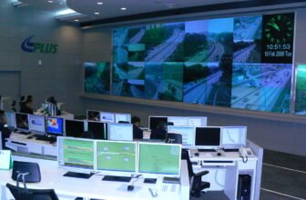
2. Air Traffic Management and Surveillance
Automatic Dependent Surveillance-Broadcast (ADS-B)
One of the most significant advancements in satellite-based aviation safety is ADS-B (Automatic Dependent Surveillance-Broadcast). ADS-B enables real-time tracking of aircraft by broadcasting their location, speed, and altitude to ground stations and other aircraft.
- ADS-B Out: Aircraft transmit their position data to air traffic control and nearby aircraft.
- ADS-B In: Pilots receive real-time traffic and weather updates, improving situational awareness.
The use of ADS-B reduces reliance on radar and enhances aircraft tracking, especially over oceanic and remote areas where traditional radar is ineffective.
Space-Based ADS-B
With space-based ADS-B, satellites collect and transmit aircraft signals, providing global coverage. Organizations like Aireon use satellite-based ADS-B to offer real-time aircraft surveillance, significantly improving tracking over oceans and polar regions.
3. Communication Systems for Pilots and Controllers
Satellite Communications (SATCOM)
Satellite communication systems are essential for long-haul flights, especially over remote areas such as oceans and polar regions, where conventional VHF and HF radio signals are weak or unavailable.
SATCOM is used for:
- Voice communication between pilots and air traffic controllers
- Data link communications (e.g., ACARS – Aircraft Communications Addressing and Reporting System)
- Providing in-flight internet access for passengers
4. Weather Forecasting and Hazard Avoidance
Satellite Weather Monitoring
Weather is a significant factor affecting flight safety. Satellites provide real-time weather data, helping pilots and air traffic controllers make informed decisions. Geostationary and polar-orbiting satellites monitor weather conditions, tracking storms, turbulence, and volcanic ash clouds that could impact flights.
For example:
- NOAA’s GOES (Geostationary Operational Environmental Satellites) provide continuous weather observations.
- EUMETSAT’s Meteosat satellites monitor atmospheric conditions over Europe and Africa.
- Japan’s Himawari satellites track typhoons and severe weather in the Asia-Pacific region.
This information helps pilots avoid hazardous weather, reducing delays and enhancing flight safety.
5. Search and Rescue Operations
COSPAS-SARSAT System
Satellites play a vital role in search and rescue (SAR) operations. The COSPAS-SARSAT system is a satellite-based distress alerting system that detects emergency beacons activated by aircraft in distress.
- Aircraft Emergency Locator Transmitters (ELTs) send distress signals.
- Satellites relay signals to ground stations, which pinpoint the aircraft’s location.
- Rescue teams are dispatched more efficiently, increasing the chances of survival.
6. Enhancing Airport and Flight Operations
Satellite-Based Landing Systems
Traditional Instrument Landing Systems (ILS) rely on ground-based signals for guiding aircraft during landing. However, satellite-based systems such as GLS (GBAS Landing System) offer more flexible and accurate approaches, especially in challenging terrains.
Geofencing and Drone Management
Satellite technology is also used to manage airspace for unmanned aerial vehicles (UAVs) and drones. Geofencing systems prevent drones from entering restricted airspace, reducing collision risks with manned aircraft.
The Future of Satellite Technology in Aviation
The aviation industry continues to evolve with advancements in satellite technology. Future innovations include:
- Next-Generation Satellite Networks: New satellite constellations such as Starlink and OneWeb promise faster and more reliable connectivity for aviation operations.
- Artificial Intelligence Integration: AI-powered satellite data analysis will enhance predictive maintenance and flight planning.
- Green Aviation Initiatives: Satellite navigation helps optimize fuel efficiency, reducing carbon emissions and promoting sustainable aviation.
Satellite technology has revolutionized aviation navigation and safety, making air travel more reliable and efficient. From precise GPS-based navigation to real-time aircraft tracking and enhanced weather forecasting, satellites play an indispensable role in modern aviation. As technology continues to advance, satellite systems will further enhance aviation safety, ensuring a seamless and secure flying experience for passengers and crew alike. image/wikimedia